3D model, Holy Trinity Church & ancient trading post Cookham

Martinr36

MOST VALUED CONTRIBUTOR
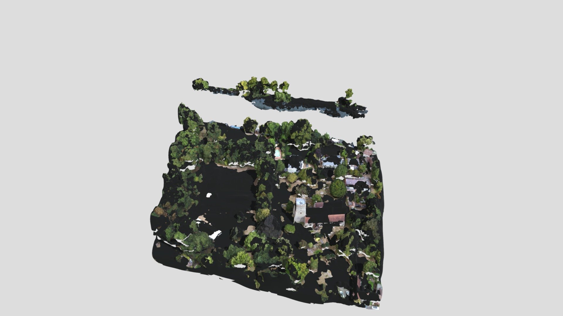
Recently an ancient trading post thought to be about a 1000 years old has been discovered adjacent to Holy Trinity Church in Cookham, Yesterday I went down and flew the drone there, and subsequently produced this 3D model of the area


B4zookaw

VALUED CONTRIBUTOR
That's really interesting. How long does it take to produce a model like this? How many mins of footage needed?
 

Steveyg

MOST VALUED CONTRIBUTOR
That's really interesting. How long does it take to produce a model like this? How many mins of footage needed?
I terms of having the actual floor plan you could put together this model in a few hours it's not very detailed. The leg work would be in the planning though, the actual digging and references of where things where in the past I imagine took years
 

Martinr36

MOST VALUED CONTRIBUTOR
That's really interesting. How long does it take to produce a model like this? How many mins of footage needed?
It took just over 13 minutes to fly and take the 142 photos that were used, then another 13 minutes to process them in WebODM
 

B4zookaw

VALUED CONTRIBUTOR
It took just over 13 minutes to fly and take the 142 photos that were used, then another 13 minutes to process them in WebODM
So WebODM basically stitches the images into a 3D map. Not bad rendering time, is it CPU or GPU intensive?

Edit: NM, it's a web based app that you access via API, right?
 

Steveyg

MOST VALUED CONTRIBUTOR
It took just over 13 minutes to fly and take the 142 photos that were used, then another 13 minutes to process them in WebODM
Here's me picturing a archaeological dig with some CAD jockey modelling the whole thing in Revit, I guess there's much easier ways
 

Martinr36

MOST VALUED CONTRIBUTOR
So WebODM basically stitches the images into a 3D map. Not bad rendering time, is it CPU or GPU intensive?

Edit: NM, it's a web based app that you access via API, right?
No I splashed the cash and purchased the windows installer for the windows native app, however if I had something that that might over tax the Berserker I could put it out to the web based version, as for being cpu or gpu intensive, that really depends on the data set you use and what settings you plug in

Here's me picturing a archaeological dig with some CAD jockey modelling the whole thing in Revit, I guess there's much easier ways
It was a peaceful time sat down by the river, watching all the boats going up and down and checking the drone was doing ok occasionally as the flight was pretty much automated, some time i might go down again and run something the other side of the river where there are houses that sell for up to about £36M
 

Steveyg

MOST VALUED CONTRIBUTOR
It was a peaceful time sat down by the river, watching all the boats going up and down and checking the drone was doing ok occasionally as the flight was pretty much automated, some time i might go down again and run something the other side of the river where there are houses that sell for up to about £36M
Mate I completely missed that you did this yourself that's amazing, I thought this was something that was done by some big project team or something

Impressive bit of technology that
 

polycrac

Rising Star
That's incredibly impressive - the rendering isn't far off the initial Google Earth models in terms of sophistication. Was it a particularly fancy camera or just Go-Pro level? I saw some early photogrammetry generated VR stuff and thought it would be two or three times as long before an amateur (no offence intended!) could match that, but you certainly have.
 

Martinr36

MOST VALUED CONTRIBUTOR
Mate I completely missed that you did this yourself that's amazing, I thought this was something that was done by some big project team or something

Impressive bit of technology that
Cheers @Steveyg , no just little old me, saw about the dig on the local newspaper site & its only about 6 miles down road, so thought I'd go take a look from 285 feet up in the air 😂

That's incredibly impressive - the rendering isn't far off the initial Google Earth models in terms of sophistication. Was it a particularly fancy camera or just Go-Pro level? I saw some early photogrammetry generated VR stuff and thought it would be two or three times as long before an amateur (no offence intended!) could match that, but you certainly have.

Thanks @polycrac ,Nothing fancy camera wise Just a DJI Mini2 drone , the specs for which as follows:

Camera The Mini 2 has a 1/2.3" CMOS sensor with a 12MP camera, the camera has a 24mm (equiv.) fixed-aperture F2.8 lens with an 83º FOV, and an ISO range of 100-3200.
 
Top